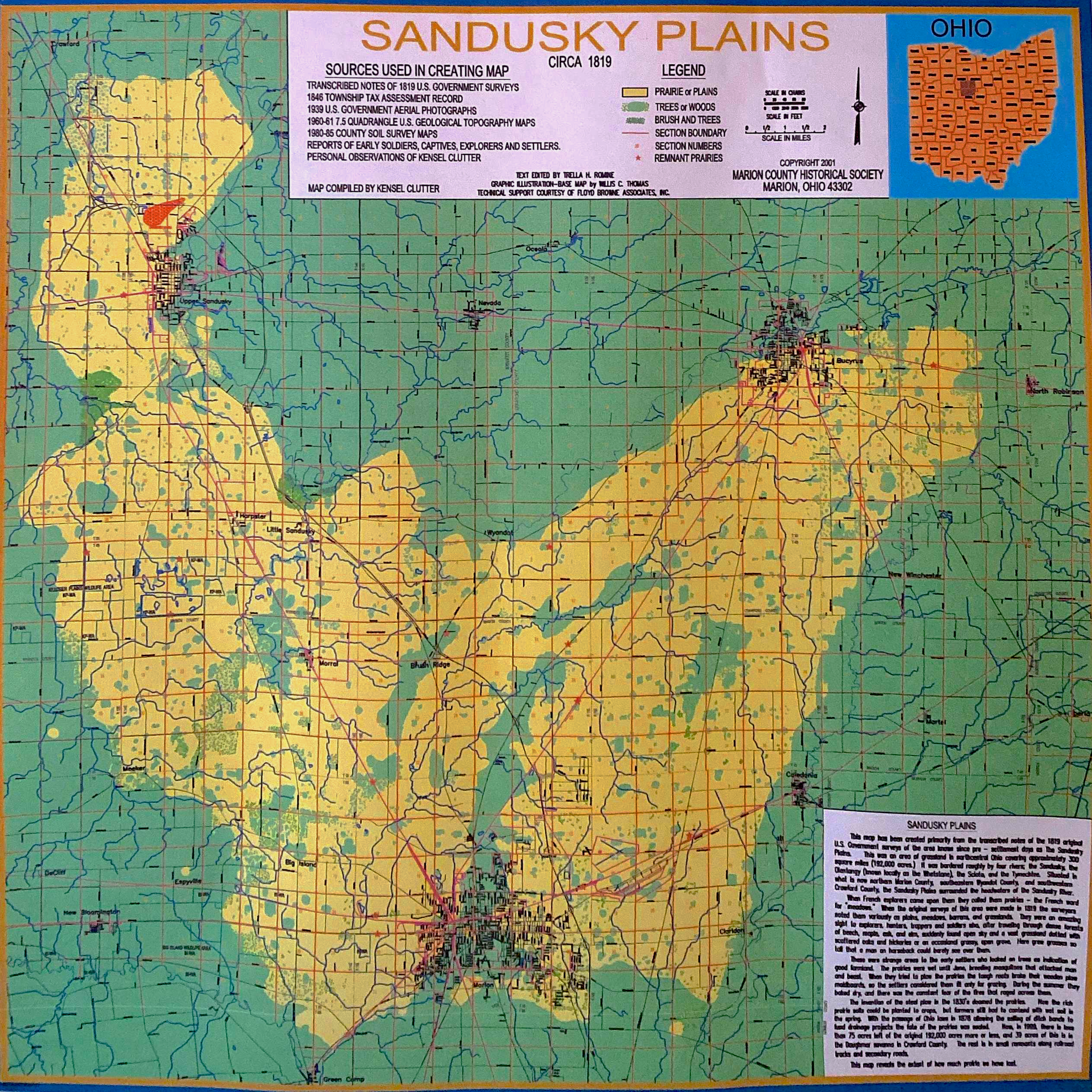
Conserving the Sandusky Plains: Mapping Remnant Railroad Prairies
“In the 1930s and 40s, one could still find remnants of prairie plants along the fences,” the Marion Star reported, paraphrasing a talk by Trella Romine about Marion County’s prairies in 1988, “but gradually farm fences began to disappear, and road crews mowed along the edges of fields, looking at the prairie plants just as weeds and producers of snowdrifts.” By the late 1960s, Ohio’s prairies had declined from perhaps a quarter of a million hectares in the early nineteenth century to just a couple dozen scattered “islands.”
Most of the surviving prairies were “railroad prairies”—unmowed right-of-way owned by the railroads that crisscrossed Ohio, irregularly burned by accidental sparks. In 1966, Robert B. Gordon, a botanist at West Chester University in Pennsylvania, completed a fifty-year long project to map Ohio’s forests and prairies as they existed in the early nineteenth century, using “witness trees” from the earliest government surveys that divided the land for dispossession and sale. This included Marion County’s “prairie archipelago.”
Over the course of several decades, Marion County farmer, historian, and conservationist Kensel Clutter worked with Trella Romine, Willis Thomas, & others to map the precise extent of Marion County’s prairies and maintain those that remained. Of those remnant prairies, the Claridon Prairie — just west of Caledonia along today’s 309 — was recognized as the most intact prairie in Marion County: ground zero for local prairie futures.


